
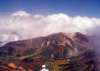
Asahidake is the tallest mountain in Hokkaido. There were many hiking courses around there.
北海道で一番高い旭岳。ロープウエイ周辺のファミリーコースから、旭岳山頂を越えてお鉢や中岳温泉を巡るコース、黒岳へと続くハイキングコースなどがある。

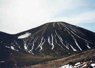
The steep slope to got to the top of Asahidake.
旭岳の山頂付近は土や石ばかりの急な坂道。
The view from the top of Asahidake.
山頂からの風景。
I walked over Asahidake. Asahidake’s back view.
旭岳を越える。旭岳の裏側。大きな雪渓の横を下った。

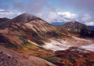
Ohachi, a big crater. There was a path along the rim of the crater, led to Kurodake.
お鉢。向こうに黒岳が見える。お鉢の縁に沿って歩いていくと、黒岳へ行ける。

Asahidake was covered with snow on the day after snowfalling. The view from Tomanokkoshi.
雪が降った次の日の旭岳。当麻乗越からの風景。
0 件のコメント:
コメントを投稿